ReadLevels
Read at your level.
One article a day, three levels your way.
What Is Latitude?
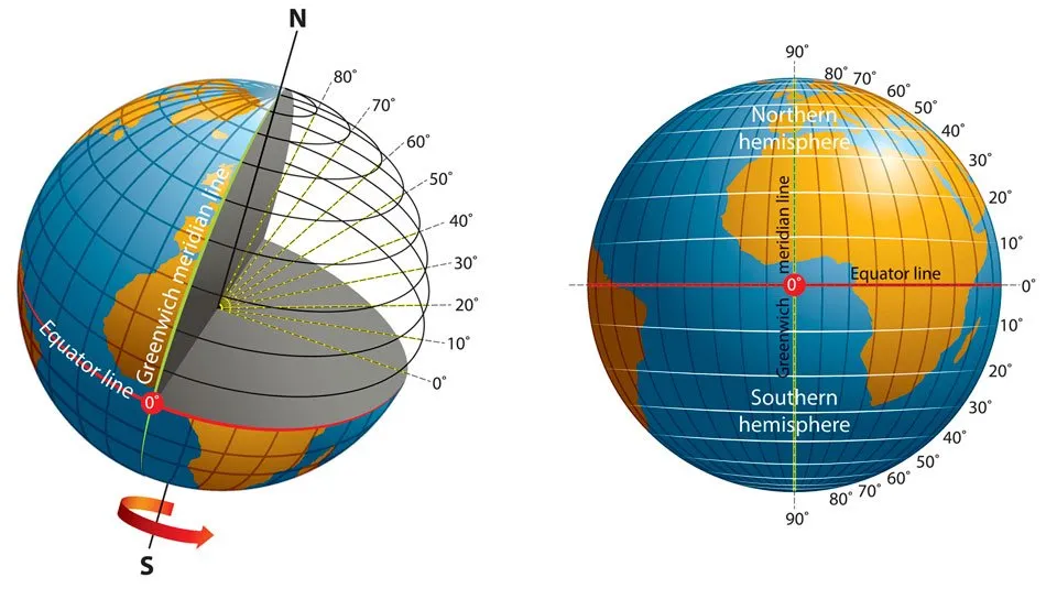
Latitude lines are also called parallels. The lines run from east to west across Earth. Latitude shows how far a place is north or south of the equator. The equator is at 0 degrees and splits Earth into two halves. The numbers grow to 90 degrees at the North Pole and the South Pole.
Some lines have special names connected to the sun. The Tropic of Cancer and the Tropic of Capricorn sit near 23 degrees north and south. The area between them is called the tropics. The Arctic Circle and Antarctic Circle sit near 66 degrees and mark the cold polar areas. These circles help scientists understand climate, weather, and ocean currents.
One degree of latitude is about 111 kilometers. Latitude lines stay the same distance apart everywhere. For a long time, sailors used the sun and stars to find latitude at sea. If the North Star was 60 degrees high, the ship was at 60 degrees north. Today, more than 30 satellites send signals to tools on the ground. As a result, modern tools can measure a place within a few centimeters.
Do you live closer to the equator or closer to a pole?
Adapted from NOAA Ocean Facts.
Select Vocabulary or Comprehension to practice.
Vocabulary
6 key words — tap a word for meaning and examples
Comprehension
6 questions