
One article a day, three levels your way.
Free graded English reading: every article comes in Easy, Medium and Hard, with listen-along audio. Vocabulary and quizzes are free with an account. Sign up free →
Longer sentences, more descriptive words (about B1)
A Busy Storm Season in the Pacific
Storm activity in the Northwest Pacific has stayed high since April 2026, when Sinlaku became a super typhoon and hit Micronesia, Guam, and the Northern Mariana Islands. By late October, the area had already seen twenty-five named storms.
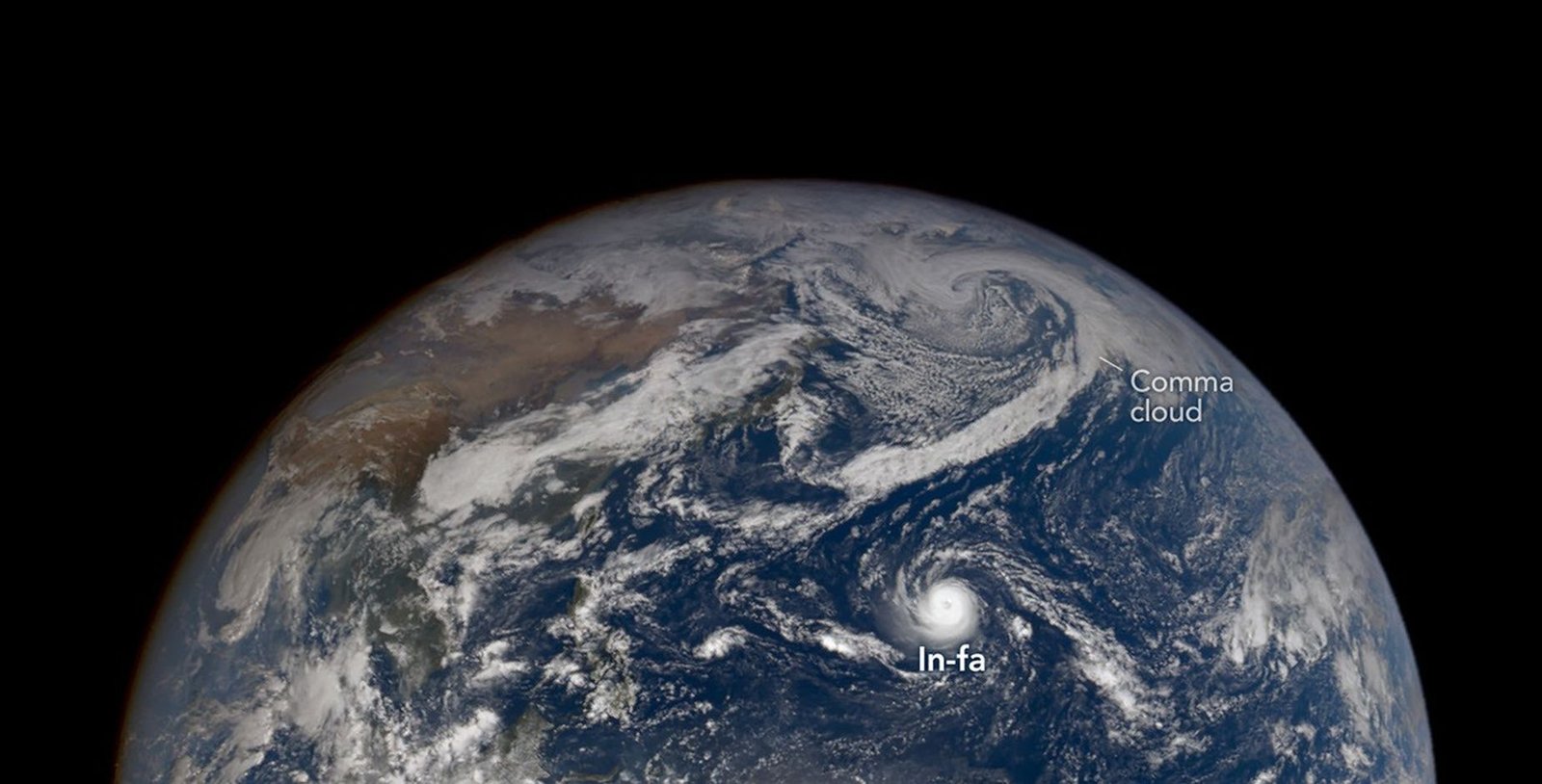
On October 29, a NASA satellite camera photographed Super Typhoon In-fa near the Mariana Islands. In the same image, the remains of Typhoon Champi were moving toward Alaska. In-fa is the fifth typhoon this year to affect the Mariana Islands.
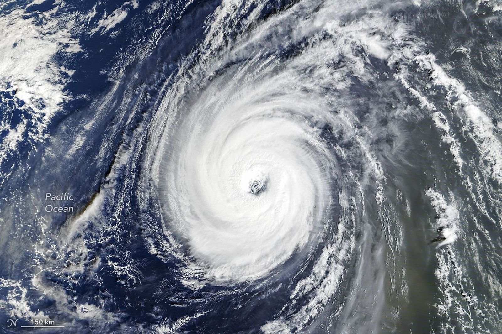
A day later, another NASA satellite showed that In-fa had a nearly round shape and a large eye. Meteorologists see this combination as a sign of a rare type of storm called an annular storm. Annular storms usually lack the spiral bands of cloud seen in ordinary tropical cyclones, so forecasters sometimes call them "doughnuts." One analysis found that they make up only 4 percent of tropical cyclones in the western North Pacific. They also tend to keep their strength longer when conditions are not good for storms.
Champi was already changing into a different kind of storm as it reached the Bering Sea. Tropical cyclones get their power from the heat and moisture of warm ocean water. Extratropical cyclones usually gain energy from the difference between warm and cold air, and they often form fronts and large, comma-shaped bands of cloud. NASA meteorologist Gary Partyka explained that a storm's winds usually spread over a much wider area during this change, although they do not necessarily get stronger.
Champi had a long and destructive path across the West Pacific, with winds near 300 kilometers (185 miles) per hour at its peak. It narrowly missed Taiwan and Guam but still brought damaging winds and heavy rain to both places. When its remains reached Alaska, news reports described high winds, heavy rain, and snow in some areas. Alaska climatologist Rick Thoman said Champi was the fourth ex-typhoon to enter Alaskan waters this year, and he estimates that about 60 have affected the state since 1970.
Partyka called 2026 a "particularly active year" for Pacific tropical cyclones, and he said the strong El Niño now underway is a "likely contributor." El Niño is a climate pattern that appears about every two to seven years, with warmer-than-normal water in parts of the equatorial Pacific. According to some experts, it makes storms in the Northwest Pacific more likely to curve north instead of moving west toward East Asia and Southeast Asia. This sends more storms toward Guam, the Northern Mariana Islands, Japan, and the Korean Peninsula.
How might El Niño change the path of storms in the Northwest Pacific?
Adapted from NASA Earth Observatory.
Select Vocabulary or Quiz to practice.
Vocabulary
12 key words — tap a word for its meaning and an example
Quiz
7 questions