
One article a day, three levels your way.
Free graded English reading: every article comes in Easy, Medium and Hard, with listen-along audio. Vocabulary and quizzes are free with an account. Sign up free →
Longer sentences, more descriptive words (about B1)
Heavy Rains Flood the Gandak River
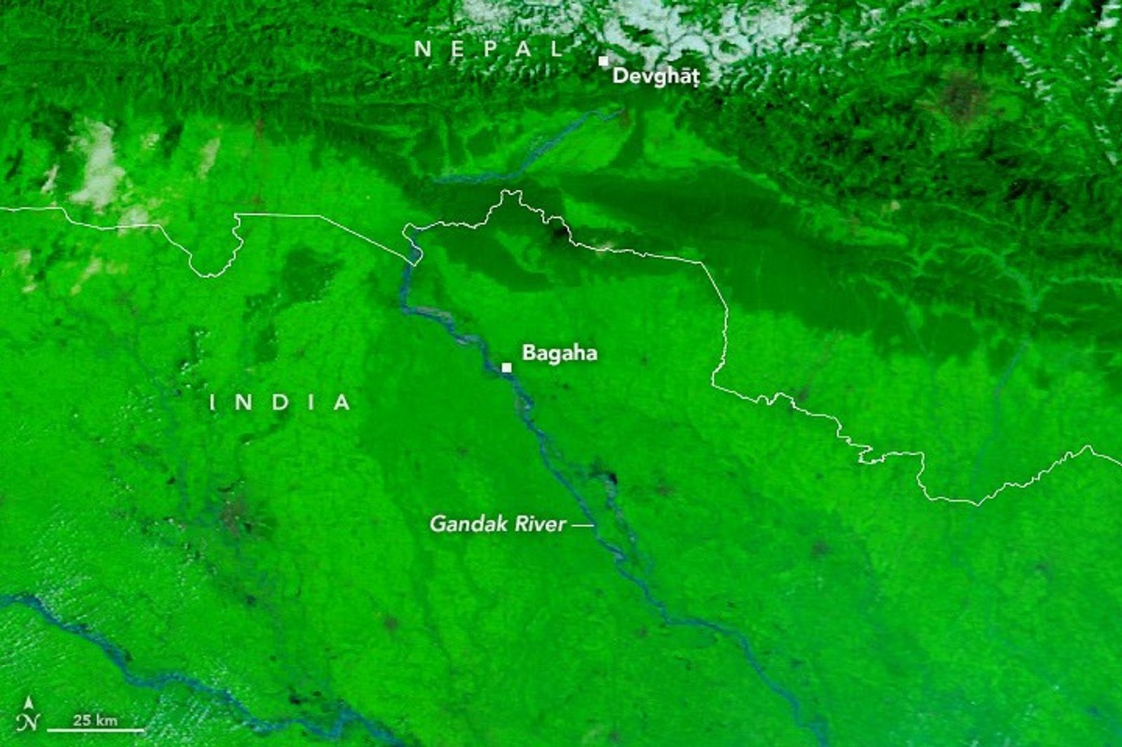
Repeated storms brought heavy rain to Nepal’s mountainous Lumbini and Gandaki provinces from September 24 to 27. The rain arrived late in the monsoon season. It set off landslides and raised the Gandak River, also known as the Narayani, to record levels in both Nepal and India.
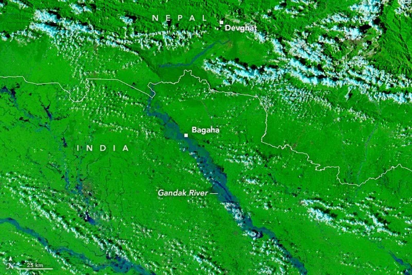
Runoff entered the river’s network of channels and caused the water to rise over embankments in several places. Farmland and settlements were flooded along the river for hundreds of kilometers. As officials worked to measure the full damage, news reports said flooding and landslides had reached hundreds of villages. Thousands of people were forced to leave their homes.
Images from NASA’s Terra and Aqua satellites, taken on September 20 and September 29, 2026, show how widely the flood spread. These false-color scenes combine infrared and visible light so water can be seen more easily. Floodwater appears blue, vegetation appears bright green, and clouds appear light blue. In many places, the water covered seasonal fields on low sand and silt deposits inside the channel, known as diara, where flooding is expected. It also crossed embankments into inhabited areas, including parts of Bagaha, Areraj, and Fulia Khand.
A gauge at Devghāṭ in Nepal reached 11.94 meters on September 27. This was the highest reading since measurements began there in the 1960s. News reports said gauges in India along the Gandak also set new high-water marks. NASA provides several tools and data sets that help people track rainfall and flooding.
How did the satellite images help show the spread of flooding along the Gandak River?
Adapted from NASA Earth.
Select Vocabulary or Quiz to practice.
Vocabulary
10 key words — tap a word for its meaning and an example
Quiz
9 questions