
One article a day, three levels your way.
Free graded English reading: every article comes in Easy, Medium and Hard, with listen-along audio. Vocabulary and quizzes are free with an account. Sign up free →
Longer sentences, more descriptive words (about B1)
Hurricane Polo Strengthened at an Extreme Speed
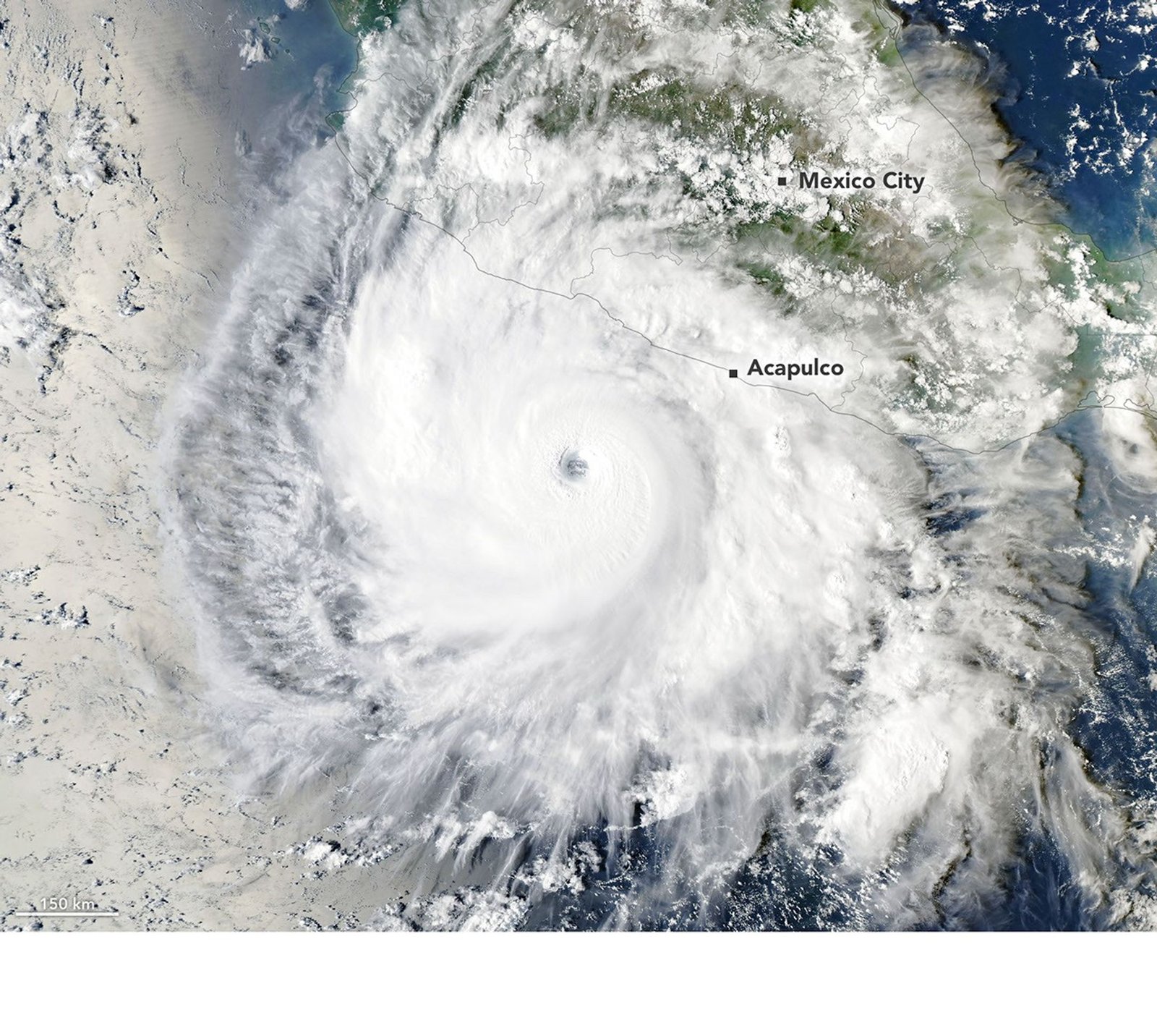
Hurricane Polo formed in mid-September 2026 off Mexico's Pacific coast. It became a tropical depression on September 20 and a tropical storm the following day. The storm then strengthened at an unusually fast pace under nearly ideal conditions. These conditions included low wind shear, plenty of moisture, above-average ocean temperatures, and unstable air. A NASA scientist described the change as explosively rapid intensification.
Experts used the term extreme rapid intensification for this growth. The term means winds rose by at least 111 kilometers per hour within 24 hours. By September 22, Polo's strongest winds had increased by 167 kilometers per hour in one day and reached category 5. The National Hurricane Center called the change truly remarkable. A research aircraft estimated winds of nearly 285 kilometers per hour. Some analysts said Polo was the third-strongest eastern Pacific storm on record. They also said it was the fastest on record to rise from a tropical depression to category 5.
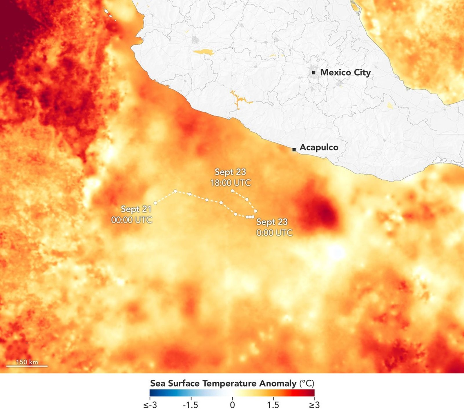
On September 23, a NASA satellite observed Polo off Mexico, southwest of Acapulco. Maximum winds were then 230 kilometers per hour, so the storm stood at category 4 after a slight drop in intensity. One scientist said the view was striking because of Polo's large, clear eye and the strong flow of air out of its top. Light winds above the storm also helped the rapid intensification. As Polo developed, it crossed waters as warm as 32 degrees Celsius, 2 to 3 degrees above typical values. Warm water below the surface likely helped the storm keep its strength.
Scientists warned against treating El Niño's warm Pacific waters as a direct explanation for Polo's surge. Other storms in the same region have intensified rapidly during different climate conditions. These include Hurricane Otis in 2023 and Hurricane Patricia in 2015, both of which reached category 5. Still, storm activity in the eastern Pacific usually rises during El Niño, and that pattern has been clear in 2026. By September 24, total storm energy in the region was nearly twice the typical amount. Forecasters expected Polo to remain over the Pacific until the following week. After that, it may turn northeast and approach Baja California.
Why did scientists say El Niño was not a direct explanation for Hurricane Polo's rapid intensification?
Adapted from NASA Technology.
Select Vocabulary or Quiz to practice.
Vocabulary
10 key words — tap a word for its meaning and an example
Quiz
11 questions